Water appears in many different forms on our walks in Andalucía. Sometimes it is little more than a narrow channel running quietly beside the path. On another day, it might emerge unexpectedly from beneath a limestone mountain, flow through a river valley or fill one of the great reservoirs of the Guadalhorce.
At first, these can seem like completely separate features of the landscape. But look a little more closely and a connection begins to appear. For centuries, people have found different ways to capture, move, store and use one of Andalucía's most valuable natural resources.
The scale may change enormously, but the story is often the same: where the water goes, people and the landscape respond.
Where the Water Begins
Much of the water we encounter starts in the mountains, although its journey isn't always obvious.
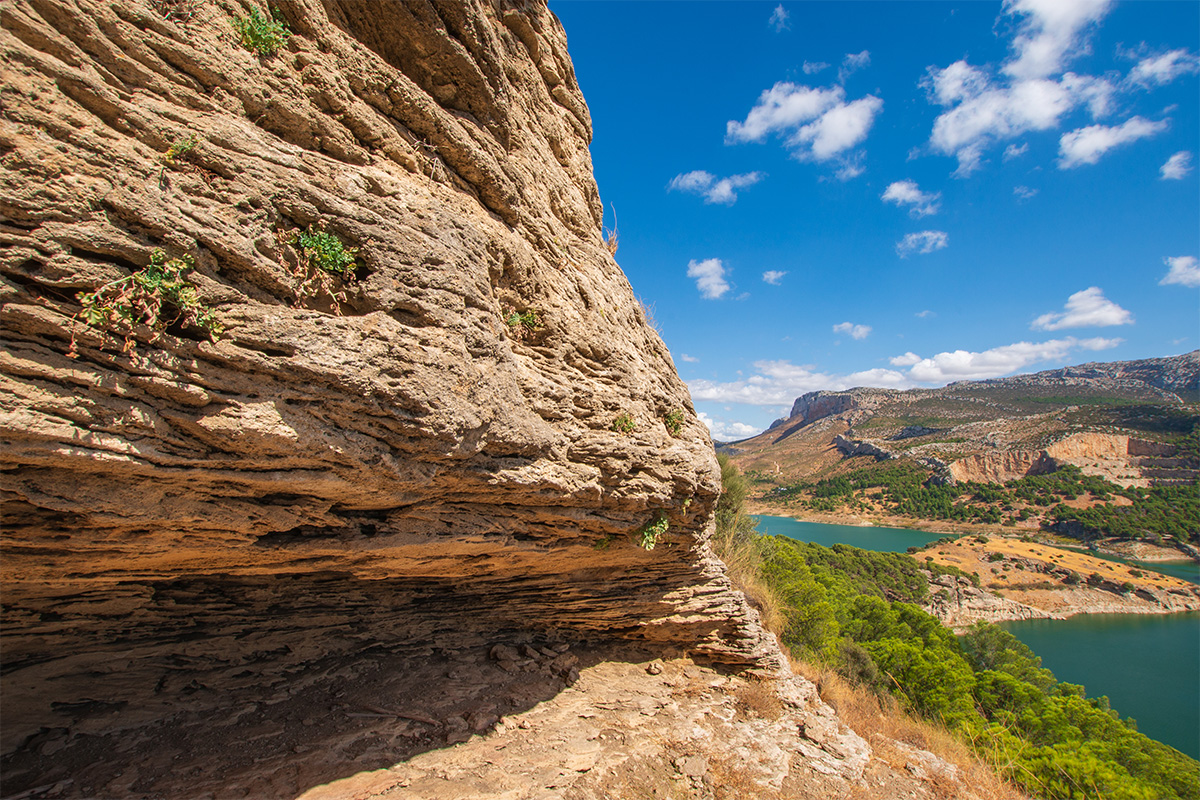
Around Hondonero, beneath the Sierra de Camarolos, the limestone can appear remarkably dry. Rain falling onto these mountains finds its way into cracks and fissures in the rock, with some travelling underground into the aquifer below. Where the geology allows, it eventually returns to the surface as springs.
Walk beneath the mountains and you begin to see the evidence. Water emerges to feed small streams, pools and traditional stone pilares, while the surrounding meadows and cultivated land become noticeably greener.
Some of this water feeds the Río Cerezo, which flows towards Villanueva del Rosario before eventually joining the Guadalhorce. What begins as rain disappearing into a limestone mountain has become part of a river system that will ultimately travel all the way to the Mediterranean.

Making Every Drop Count
Move across to the Axarquía and people developed another response to the problem of getting water where it was needed.
Here, steep mountainsides and deep river valleys meant that having water nearby wasn't necessarily enough. A river flowing far below was of little use to orchards and cultivated terraces higher on the slopes.
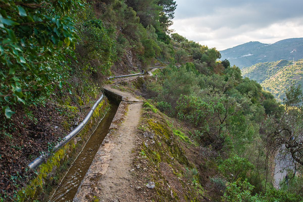
The solution was the acequia. Water could be diverted from a river or mountain spring while it still had height, then carried gradually around the contours of the hillside using little more than gravity. Smaller channels distributed it to fields, gardens and orchards.
Look downhill from one of these channels and its importance becomes clearer. Terraces cut into steep slopes created cultivable ground, while the acequia provided the water needed to make that land productive. Together they helped create the agricultural landscape surrounding villages such as Frigiliana, Cómpeta and Canillas de Albaida.
A narrow channel beside the path can therefore help explain much of what surrounds it: terraces, orchards, farmhouses and villages that generations of people have built and maintained in difficult mountain terrain.
Putting Water to Work
Water wasn't valuable only because it could irrigate crops. Once it was moving downhill, it could also provide power.
In the Axarquía, acequia systems supplied mills and workshops as well as agricultural land. Around Frigiliana, water was used to drive flour mills and later contributed to the town's historic paper-making industry.
We find a similar story beneath the mountains at Hondonero. Water emerging from the Sierra de Camarolos feeds the Río Cerezo, and for generations that water powered flour mills closer to Villanueva del Rosario.
One of them, the Molino de las Tres Piedras, used diverted river water to drive three millstones. By the early twentieth century, the same basic source of energy was even being used to generate electricity for the village.
That small development points towards a much bigger change taking place further downstream.
When the Scale Changed
In the Guadalhorce, the relationship between people and water eventually became far larger.
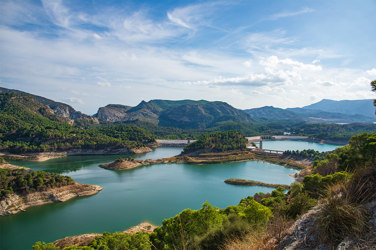
The Guadalhorce and its tributaries collect water across an extensive inland basin before converging near the limestone barrier of the Gaitanes Gorge. During the twentieth century, dams and reservoirs transformed how that water could be managed.
Instead of simply diverting part of a river into an irrigation channel or mill, engineers could now store enormous quantities of water. The reservoirs provided water for agriculture, industry and the growing city of Málaga, while the steep fall through the Gaitanes Gorge created an opportunity to generate hydroelectric power.
That engineering also left behind something rather unexpected.
Workers needed access to the canals, pipes, and hydroelectric infrastructure built through the gorge, so they constructed narrow walkways high above the river. One of those maintenance routes eventually became the Caminito del Rey.
Today, thousands of people come to walk its famous boardwalks. Yet the path itself is another part of the water story, created because engineers looked at the river, the gorge, and the difference in height, and thought about how that water could be put to work.
From Mountain Spring to Reservoir
An acequia in the Axarquía and a great reservoir in the Guadalhorce can seem to have very little in common. One might be narrow enough to step across, while the other stretches for kilometres between the mountains.
But both reveal something about the relationship between people and water.
Mountain springs provided drinking water and sustained agriculture. Acequias carried water across steep hillsides. Rivers powered flour mills. Reservoirs stored water on a completely different scale, while dams and falling water generated electricity.
Seen together, features encountered on very different walks start to form part of the same story. A spring beneath a limestone mountain, an old mill beside a river, an acequia disappearing around a hillside and a dam spanning a valley all show different ways in which water has influenced the landscapes we walk through.
Water hasn't simply passed through these landscapes. For generations, people have adapted their lives and the land around where it flows, where it emerges and what they could make it do.